Geography Games
by Mark Meyer · Posted in: musings · nerdiness
This space has been a little slow while I was in Texas finishing up a photography contract for the U.S. Department of Agriculture. On the flight between Dallas and Seattle we had clear weather giving us passengers a beautiful aerial tour of the western United States. The book I brought to entertain myself was not hitting the spot, so I decided to play a little game with my phone camera.
It goes like this:
- Take photos of anything out the window that looks interesting.
- When you get home, try to identify the geography using Google Earth or Maps
- Post to blog
Here are a few highlights:
note: I've added links to Google Maps but since I'm looking toward the south-southwest, the maps will be rotated almost 180 degrees compared to the photos. The Google Earth links will download a kmz file which you should be able to view in Google Earth.Sangre de Cristo Range, Colorado
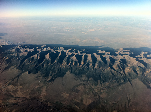
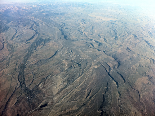
Rising like a set of vertebrae out of the plains, this part of the Rocky Mountains is very distinctive and easy to see in Google Earth if you have a general idea of where you were. These are fault-block mountains, or horsts and are accompanied by fault lines on both sides of the range accounting for their abrupt rise. The Sangre de Cristo Mountains are a long chain stretching from New Mexico into Colorado forming the southern terminus of the Rockies. This particular section is known as the Crestones, which contains a group of four 14,000+ foot mountains just left of center. The rough patch at the far left of the frame is Great Sand Dunes National Park.
[View in Google Maps | Download Google Earth Location]
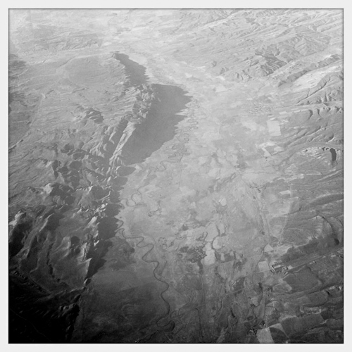
Below Calamity Ridge, Colorado
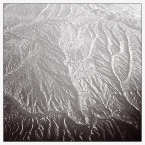
A little trickier to find this one. Yellow Creek is in the foreground running across the frame. It is a tributary of the White River, which flows into the Green River in Utah and eventually makes its way into the Colorado River in Canyonlands National Park.
[View in Google Maps | Download Google Earth Location]
Split Mountain, Utah
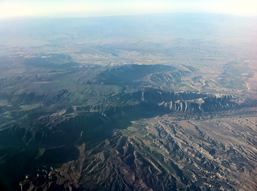
Before it meanders through most of Utah, the Green River cuts an interesting gorge right through the middle of Split Mountain in Dinosaur National Monument. It's the oddly-shaped feature extending to the right edge of the frame. For a little geographic history and an explanation of how this could happen see this quick article by Durango Bill.
[View in Google Maps | Download Google Earth Location]
Fort Bridger, Wyoming
Fort Bridge sits in the lower left. It's a little hard to see, but interstate 80 bisects the frame diagonally. In the center is a large wind farm and the Blacks Fork of the Green River is along the left edge. Fort Bridger was named after legendary mountain man Jim Bridger who established a trading post along the Blacks Fork. It was a popular stopping point on the Oregon and Mormon Trails. Looking down at the terrain and imaging crossing it in wagon makes me grateful to be on a 737. I can't help thinking of Louis C.K.—Everything's Amazing & Nobody's Happy
[View in Google Maps | Download Google Earth Location]
Crawford Mountains and Bear River Flood Plain, Utah
The Bear River has the distinction of being the largest river in the Western Hemisphere not to flow into the sea. It winds itself north around the Wasatch Mountains and eventually makes its way into the Great Salt Lake. (For the curious, the Volga which drains most of Eastern Europe into the Caspian Sea is the largest in the world.) In the distance on the right side of the photo is the town of Randolph, County Seat of Rich County, which has a distinction of its own—it had the highest percentage of people in any city in the U.S. who voted for George W. Bush in the 2004 election—95.6%.
[View in Google Maps | Download Google Earth Location]
Craters of the Moon, Idaho
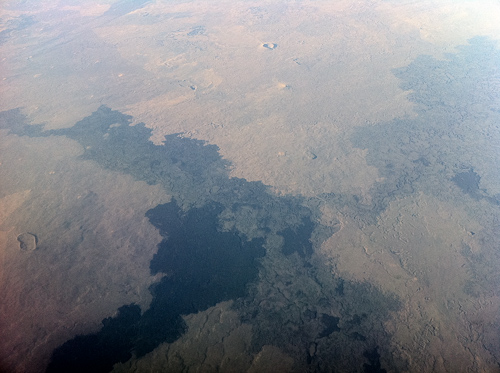
The huge black lava fields make this location quite easy to find. Historically, lava flows occurred during eruptions of the Great Rift—a 60 mile crack in the earth's crust. The volcanic activity is related to the activity in Yellowstone and is only classified as dormant, not extinct. A new eruption is expected sometime between now and the next 900 years. According to the Craters of the Moon: National Park Handbook, eruptions typically consist of curtains of lava shooting 1000 feet into the air and it could happen any day. Something to think about when exploring the preserve's lava tubes.
[View in Google Maps | Download Google Earth Location]
Columbia River, Wahsington-Oregon border
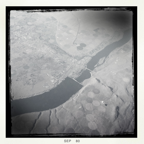
From the air it looks like two bridges crossing the Columbia River, but the structure on the left is McNary Dam which holds back the river forming a reservoir named Lake Wallula. Because it is a run-of-the-river type dam, water storage is not a principal aim—water generally flows through the dam at the same rate it enters the reservoir. Completed in the ’50s at a cost of $23.7 million, its primary purpose is to provide hydroelectric power, irrigation, and to ease barge navigation (the dam has locks allowing boats to pass). It is one of 29 major dams on the Columbia and its tributaries.
[View in Google Maps | Download Google Earth Location]